The Ximenes Project in short
In short, the Ximenes Project includes the following functions:
1) A service to automatically spread the Weather Alerts issued by the Official Istitutions, as well as the information concerning road conditions (ice, fog, heavy rain, wind etc);
2) A network, with an interactive map, to receive the data from amateur, professional and also official meteorological weather stations in the operational area of the Tuscany region;
3) A free-of- charge service, available for other institutions as well, with automatic notifications regarding climatic events in case certain default thresholds are overcome. This uses innovative, free-of charge and very user-friendly digital tools, such as Messenger, Telegram Bots and Telegram itself.
In detail
Alert system
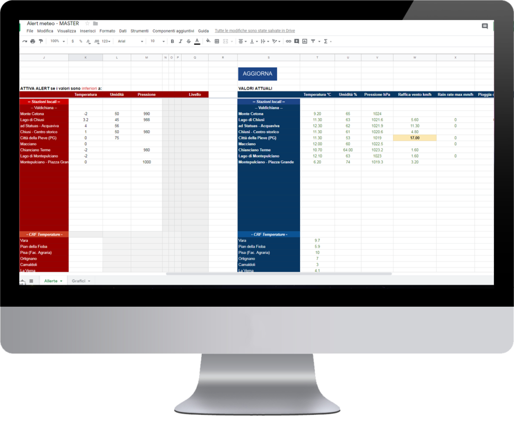
This tool enables to read the data from local stations present in both the Ximenes and CRF networks, up to a total of 900 stations. It is possible to have an overview of real time consultation, with an automatic update. The system, in addition to graphically visualizing data, also reports conditional formatting if there are values close to the alert thresholds. Through your own panel, you can set the alerts in each station and data typology when such thresholds are overcome. Notifications will be sent by e-mail and Telegram
Main consultations:
- Current temperature
- Relative humidity
- Atmospheric pressure
- Rainfall amount and its intensity per hour
- Wind speed
- Hydrometric conditions

Bot enhancement

Telegram and Messenger Services
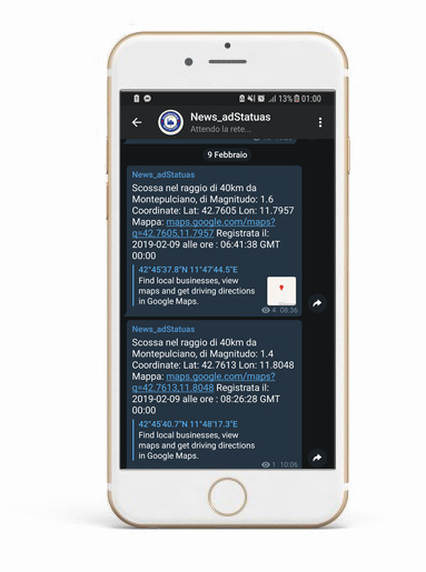
Would you like to be always informed about the website news, the meteo alert warnings, or to receive notifications regarding earthquakes with a magnitude higher than 3.5? Perfect! Follow the channel Telegram: News_adStatuas
If you want to see the weather-seismic data in real time or the latest pic taken by the webcam, interact with the discrete and innovative bot adStatuas_bot
Now you can also interact with Messenger bot! Put “I like” in the Facebook page @adStatuas and press the botton “Use the app”
Main bot consultations:
- General information
- Current temperature
- Today’s minimum temperature
- Today’s maximum temperature
- Rain Presence
- Wind speed
- Webcam image
- Seismograph
- News
Weather stations list:
- Acquaviva di Montepulciano
- Chiusi
- Chianciano Terme
- Città della Pieve
- Lago di Montepulciano
- Macciano
- Monte Cetona
Local network consultations

Local network map
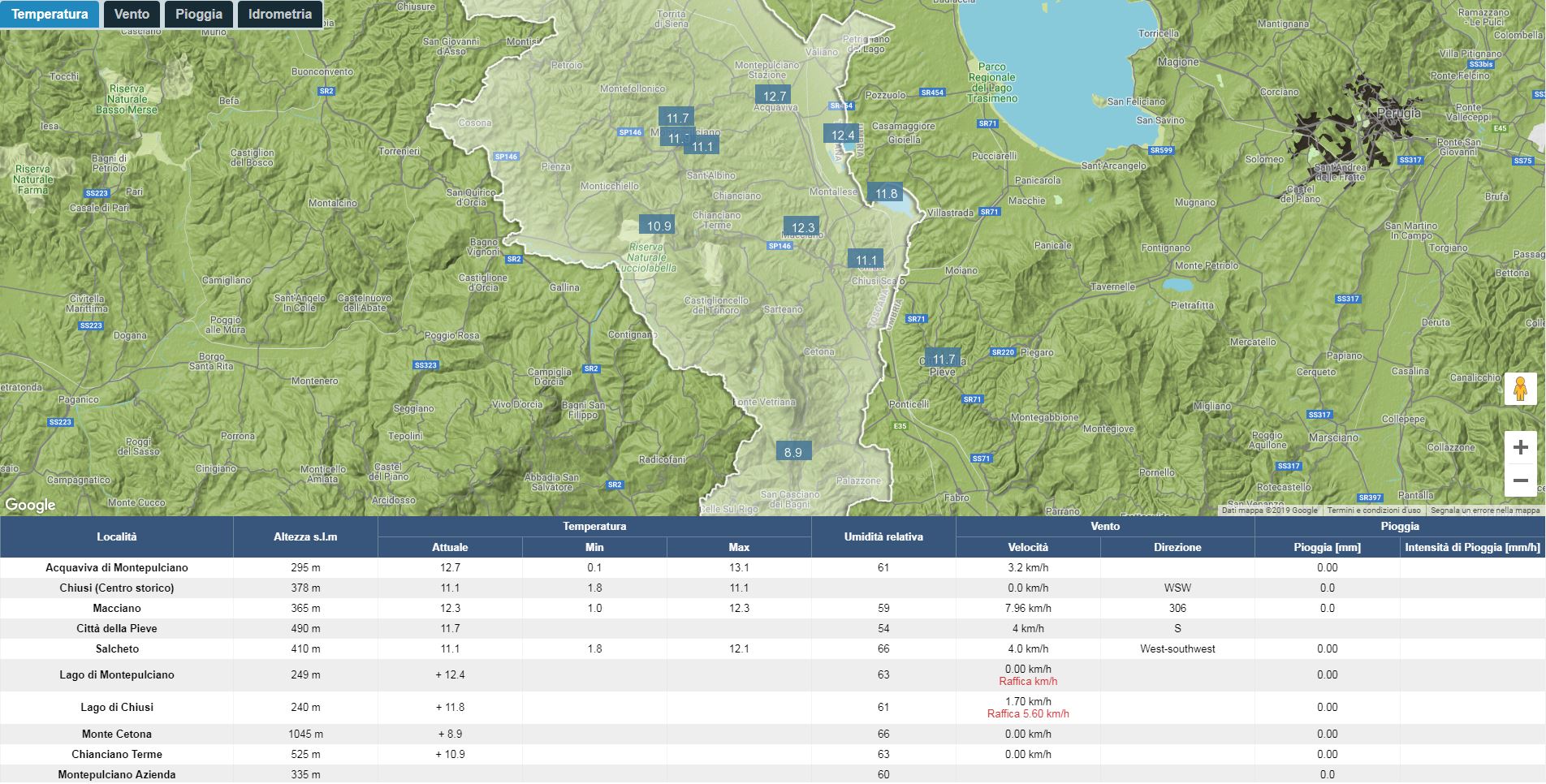
Interactive map with filters for Hydrometry, Pluviometry, Thermometry and Anemometry. It reads the data from weather stations in real time. Depending on the values, data take a different colour. One may look into data of each station in detail.
Comunications

Notifications and official alerts
The alert channel enables to automatically spread the data sent by Official Institutions. Through the xmlrcp protocol, all received e-mails containing alerts or warnings will be automatically posted on the website, on Telegram and on Facebook.
Enhancement of the seismograph

Seismograph
The seismograph of the “ad Statuas” station enables to analise the graphs in real time. The server makes a check of the monitored source (National Institute of Geophysics and Vulcanology) every 60 seconds, in order to detect earthquakes with a fixed method, focused on Val di Chiana:
- Over ML 1.0 within 40 km from Montepulciano
- Over ML 3.6 in Italy
- Over Mw 7.0 in the rest of the world
Supported by:


